Kehlen
 |
, the town of Kehlen, which lies in the centre of the commune, has a population of 1,627. Other towns within the commune include Dondelange, Keispelt, Meispelt, Nospelt and Olm.
The history of Kehlen goes back at least to Gallo-Roman period. Celtic tombs have been excavated in nearby Nospelt and a necropolis from the 1st century was discovered in the early 1970s on the Juckelsboesch plateau between Mamer and Kehlen. A beautiful dark blue glass bowl was among the offerings found there.
A monument to the four gods depicting Juno, Minerva, Mercury and Hercules, possibly once the base of a Jupiter Column, was discovered on the heights of Schoenberg at the point where two Roman roads once crossed. The original is now in the National Museum of History and Art but a replica can be seen beside the entrance to the Schoenberg cemetery.
Schoenberg is one of the oldest parishes in Luxembourg. It came under the authority of the St. Maximin's Abbey, Trier, as far back as 1637. The cemetery is classified as a national monument as many of the gravestones are from the beginning of the 16th century.
Until fairly recently, Kehlen was a farming community with a few cottage industries. Today, owing to its proximity to Luxembourg City (about 25 minutes by car outside the city), most of its inhabitants now work in the service sector.
The name Kehlen is said to originate from Callidovilla meaning the villa of Callidus.
Map - Kehlen
Map
Country - Luxembourg
 |
 |
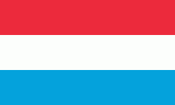
| Flag of Luxembourg | |
With an area of 2,586 km2, Luxembourg is one of the smallest countries in Europe, and the smallest not considered a microstate. In 2022, it had a population of 645,397, which makes it one of the least-populated countries in Europe, albeit with the highest population growth rate; foreigners account for nearly half the population. Luxembourg is a representative democracy headed by a constitutional monarch, Grand Duke Henri, making it the world's only remaining sovereign grand duchy.
Currency / Language
| ISO | Currency | Symbol | Significant figures |
|---|---|---|---|
| EUR | Euro | € | 2 |
| ISO | Language |
|---|---|
| FR | French language |
| DE | German language |
| LB | Luxembourgish language |


